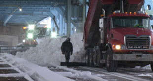
Upper Michigan winters are severe, so preparedness, awareness and common sense are always important when facing winter hazards.
In an effort to raise awareness about the potential dangers of the upcoming winter season, Governor Rick Snyder has declared this to be Winter Hazards Awareness Week in Michigan.
Matt Zika with the National Weather Service in Marquette says it’s good that the campaign comes early enough so that U.P. residents can get prepared before the first big snowfall.
During Winter Hazards Awareness Week, Michigan residents are encouraged to learn about the dangers associated with cold, snow and ice and how to stay safe during the winter season.
The first snowstorm hit the U.P. last winter on Veterans Day where some places saw two feet of snow.
Zika says that’s not likely to happen again this year.
Winter Hazards Awareness Week runs through November 7th.
You can here the entire interview with Matt Zika on Sunday’s Copper Country Today.
Here is the full press release from the NWS:
Winter will be here soon. In an effort to raise awareness about the potential dangers of the upcoming winter season, Governor Rick Snyder has declared November 1 – 7, 2015, as Winter Hazards Awareness Week in Michigan.
Upper Michigan winters are severe, so preparedness, awareness and common sense are always important when facing winter hazards. During Winter Hazards Awareness Week, Michigan residents are encouraged to learn about the dangers associated with cold, snow and ice and how to stay safe during the winter season.
The early part of last winter averaged out pretty close to normal, but a record cold February gave the perception that last winter was similar to the historically cold winter of 2013/2014.
The cold last February allowed Lake Superior to freeze over for the second consecutive year. The first time that has happened in the modern satellite era. Snowfall across the U.P. last winter averaged a little below normal with the typical higher terrain of the Keweenaw Peninsula seeing the most seasonal snowfall around 250 inches.
The biggest snowstorms of last winter occurred on Veteran’s Day and on Valentine’s Day.
Are we in for another unusually cold winter this year? While seasonal forecasting is always a challenge, there is higher confidence than usual with the outlook for the upcoming winter based on the presence of a very strong, possibly record breaking, El Nino.
El Nino is an ocean-atmospheric phenomenon in the Tropical Pacific that affects global weather patterns. In strong El Nino years, winters are typically warmer and drier than average across the Pacific Northwest, the Northern Plains, and the Upper Great Lakes and cooler and wetter than average along the southern tier of the U.S.
Thus, a repeat of the last two winters’ unusual cold for the Upper Great Lakes seems unlikely at this time.
While odds favor our average temperature over the entire winter to be above normal, we know that during any U.P. winter there are some certainties. It will soon be getting colder and there will still be plenty of episodes of wintry weather to deal with during the next six months. Thus, now is the time to get prepared for the upcoming winter. Many simple preparations can be taken including making sure your car is ready for the colder weather, having a survival kit in your car, ensuring you have warm coats, hats, and gloves, and being aware of potential fire and carbon monoxide hazards from alternate heat sources such as a fireplaces, wood stoves or space heaters.
For more information on how to prepare for the upcoming winter season, visit the National Weather Service Marquette website at www.weather.gov/mqt, or follow us on Facebook (facebook.com/NWSMarquette) or Twitter (@NWSMarquette).
 Keweenaw Report Your Source for Local News and Sports


