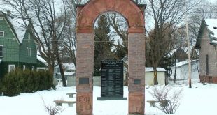
 While many students spent their summer vacation playing video games and catching up with friends, teenagers from Houghton and Calumet high schools have spent much of their summer vacation walking the streets of Calumet and Laurium, and charting their findings.
 “The students spent five weeks collecting information about the local community such as the condition of sidewalks, diverse amenities in parks, where public buildings are and commercial buildings that may be available for rent. They put those together into a web application that everyone in the community can use to learn more about the community and to help encourage economic development and tourism,” said Don Lafreniere of Michigan Technological University.
 Merlin Steffensen is an intern who worked on the project and said, “We started out doing digitalization of buildings. We drew all of the buildings in on the maps so they were accessible through our map. After that, we went out in the field in Calumet and Laurium, collected information such as the trees, building information, locations of street lights, fire hydrants, things of that nature.’
That data is now available for public use, and was presented Thursday night at CLK High School to community members and officials.
 “It’s meant to be an infrastructure, a digital spatial infrastructure that can be used either for the community to learn more about the amenities or features of their community. Something that’s web accessible that anyone can look at. It’s also designed for planners or administrators or members of municipal government to track their infrastructure, to look at the built environment and to make decisions based on that and to also be able to change and update it as they do their own improvements or construction projects or something of that nature,” stated MTU graduate student Dan Trepal.
 As the team unveiled their project to community members, they were greeted with enthusiasm and asked to give a second presentation to the village council that would have natural uses for the data.
“Municipal GIS is a very common thing so you’re seeing it in villages and towns much more often now, of course. Calumet and Laurium did not have one at this point, so one of the things that we did as part of this project was to build one using the interns,” said Trepal.
The GRACE project was sponsored by the National Science Foundation, in conjunction with Michigan Tech, Eastern Michigan University, and the National Park Service and gave the students an opportunity to learn more about local history while working on the assignment.
“I learned a lot about the historical features in Calumet and the recreational areas. Those were big things that we wanted to emphasize in the visitors map,” said Steffensen.
 Elicia Giachino is a Calumet student who believes that this project will assist her in her career path after high school.
Giachino said, “I’ve been thinking about going into archaeology or anthropology and Dan has definitely told me a lot about how important it is to use geography in archaeology and to see where things were, and where they are now and GIS. This is the perfect software to use for that to compare where things were and where they are now and how they’ve changed over time.”
Those maps can be viewed at www.calumetmap.com